Description
Bushwalking In Australia, 320 pages, A5 in size – full colour throughout, 181 colour photographs, 56 colour topographic maps, 4th edition published in June 2003, previous editions were published by (Lonely Planet) LP in 1988, 1992 and 1997.
Contains track notes for 25 walks plus brief planning and preparation notes. For each walk there are notes for Duration, Standard, When to Walk, Equipment, Permits, Maps and Access and of course detailed walking notes. With the change to self-published this has allowed us to include many new design innovations including:
- Notes divided into sections by distances and these distances are marked on the maps making it easy to switch between the notes and the maps
- Start and Finish of all walks clearly indicated
- Gradient profiles (a graph showing ascents and descents) provided for each walk
- Maps changed to be full colour topographic maps with grids and magnetic deviation displayed
- Side trips and alternative track notes placed into shaded boxes thus making it clear which are the main notes and which are extras
- Weather charts for each walk
- Photographs displayed beside the text they illustrate – not many pages away in sections of colour inserts
- All photographs are taken on the walks and show what the guidebook user will see – no images of nearby or similar places used
The guide contains only overnight or longer walks and with colour contour maps at either 1:100,000 or 1:50,000 scales. None of the strange map scales like 1:40,000, 1:80,000 etc or the really useless scales for walking like 1:250,000 which appear in some other books or our previous LP editions appear in the new edition of this guide. Rather than describing masses of walks in skimpy detail to make it look numerically attractive, the walks have full track notes of the standard walkers who use our Tasmania and other guides have come to expect.
Walks included in the 4th (2003) edition of Bushwalking In Australia are:
- New South Wales – Grose Valley, Corang Peak to the Castle (Budawangs), Upper Ettrema Creek (Budawangs), Koscuiszko Main Range, Geehi to Mt Townsend (includes Lady Northcotes Canyon)
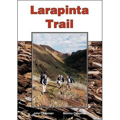
- Northern Territory – Chewings Range, Simpsons Gap to Alice Springs (the two walks describe the first 3 sections of the Larapinta Trail near Alice Springs)
- Queensland – Mt Bartle Frere, Thorsborne Trail (Hinchinbrook Island)
- South Australia – Gammon Ranges, Wilpena Pound
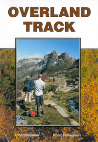
- Tasmania – Overland Track, Mt Field, Freycinet Peninsula, Cape Pillar (note this walk is now called the ‘Three Capes Track’, you can still walk the original tracks but in reverse using tents without paying a high fee)
- Victoria – Mt Feathertop & Bon Accord Spur, The Viking Circuit, Wilsons Promontory Southern Circuit, Beeripmo Walk (a new track west of Ballarat), The Fortress (in the Grampians), Great Southwest Walk
- Western Australia – Monadnocks Traverse (near Perth), Tingle Forest (near Walpole on south coast), Rame Head to Denmark (also on south coast), Stirling Range
In all – the guide includes 25 overnight and longer walks with 9 new walks not in the 3rd edition. There are walks for all standards with 4 easy, 7 easy-medium, 6 medium, 4 medium-hard and 4 hard walks.