Description
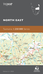
The design of the 1:50 000 Map Series provides clear and accurate portrayal of topographic information, with symbols and map content giving enhanced depiction of buildings, hill shading and a simplified classification of vegetation.
The slice of coastal heaven that is the Bay of Fires stretches over 50 kilometres from Binalong Bay in the south to Eddystone Point in the north. This area of Tasmania’s east coast has been named by Lonely Planet as the hottest travel destination in the world and is widely regarded as one of the most beautiful places in Australia. It is famous for its crystal-clear waters, white sandy beaches and orange lichen-covered granite boulders with the name referring to the Aboriginal fires spotted by Captain Tobias Furneaux when he sailed past in 1773. The Bay of Fires area contains rocky gullies, with many small secluded beaches and inlets to explore. There’s a wealth of local wildlife to discover too. The area is renowned for its snorkeling, diving and game fishing and campsites are located in the southern and middle sections of the conservation area. The coastal town of St Helens is located at the southern entrance to the conservation area and offers places to stay plus services and facilities.
- Edition: 1
- Production Year: 2020
- Datum: Geocentric Datum of Australia 2020 (GDA2020)