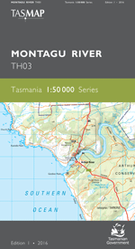
Description
The 1:50 000 Map Series provides clear and accurate portrayal of topographic information, with symbols and map content giving enhanced depiction of buildings, hill shading and a simplified classification of vegetation.
The map is an essential navigation tool when traversing the wilderness areas south of Lake Pedder. Several important tracks giving access to the Western Arthur Range, the Eastern Arthur Range, Port Davey and the Huon are a feature of the map. The area may be subject to extreme weather including low visibility, wind, snow and storm at any time of the year.
- Edition: 1
- Production Year: 2016
- Datum: Geocentric Datum of Australia 1994 (GDA94)