Description
The design of the 1:50 000 Map Series provides a clear and accurate portrayal of topographic information, with symbols and map content giving enhanced depiction of buildings, hill shading and a simplified classification of vegetation.
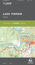
This map’s central feature is the 50 kilometre long hydro lake bearing that name. The map covers an area of Tasmania¿s mining and mineral exploration belt and includes the towns of Rosebery and Zeehan. The area is popular with prospectors and people undertaking adventurous activities. Mt Heemskirk in the south west has historical significance in that it was named in recognition of the first European sighting in 1642 of what is now Tasmania.
- Edition: 1
- Production Year: 2015
- Datum: Geocentric Datum of Australia 1994 (GDA94)

