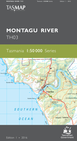
Description
The design of the 1:50 000 Map Series provides a clear and accurate portrayal of topographic information, with symbols and map content giving enhanced depiction of buildings, hill shading and a simplified classification of vegetation.
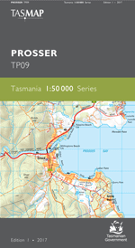
The area portrayed on this map is dominated by the extensive waterways of Frederick Henry, Norfolk, Blackman and Marion bays and Pitt Water. Close to Hobart, waterways and surrounded by farmland, the growing commuter communities of Lauderdale, Seven Mile Beach, Midway Point, Sorell, Lewisham, Dodges Ferry and Primrose Sands attract residents and visitors alike. Dunalley, a quiet and pretty fishing village is located at the impressive Denison Canal that cuts through the neck of land connecting the Forestier Peninsula. With spectacular scenery, rich heritage, great bushwalking, boating and fishing opportunities, this map is an essential navigational aid.
- Edition: 1
- Production Year: 2017
- Datum: Geocentric Datum of Australia 1994 (GDA94)