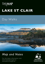
Description
A special edition of one of our most popular productions. This map is printed on JPP synthetic, a high – tech alternative to paper, which has extra strength, durability and water resistance.
Walkers in this park can expect rapid changes in weather at any time of the year, ranging from strong wind, sleet, snow or rain to blazing sun, so a reliable map is an essential companion for a safe journey.
Rugged mountain ranges, alpine gardens, waterfalls, temperate rainforests and unique wildlife abound in the Cradle Mountain – Lake St Clair National Park, one of Tasmania’s most famous natural areas.
This map highlights the walking tracks and features tourist information along with general topographic detail and is essential for walkers traversing the world famous Overland Track. The notes on the reverse side introduce visitors to the vegetation, land forms, animals, history of the area, bushwalking tips, safety essentials and booking requirements for the Overland Track.
- Production Year: 2020
- Datum: Geocentric Datum of Australia 1994 (GDA94)
- Scale: 1:100,000